Katiu! (Fifth Atoll for us . . .)
We began our trek to the “atolls less visited” when we diverted to Katiu. Is it a diversion if it’s planned? I don’t think so. Anyway.
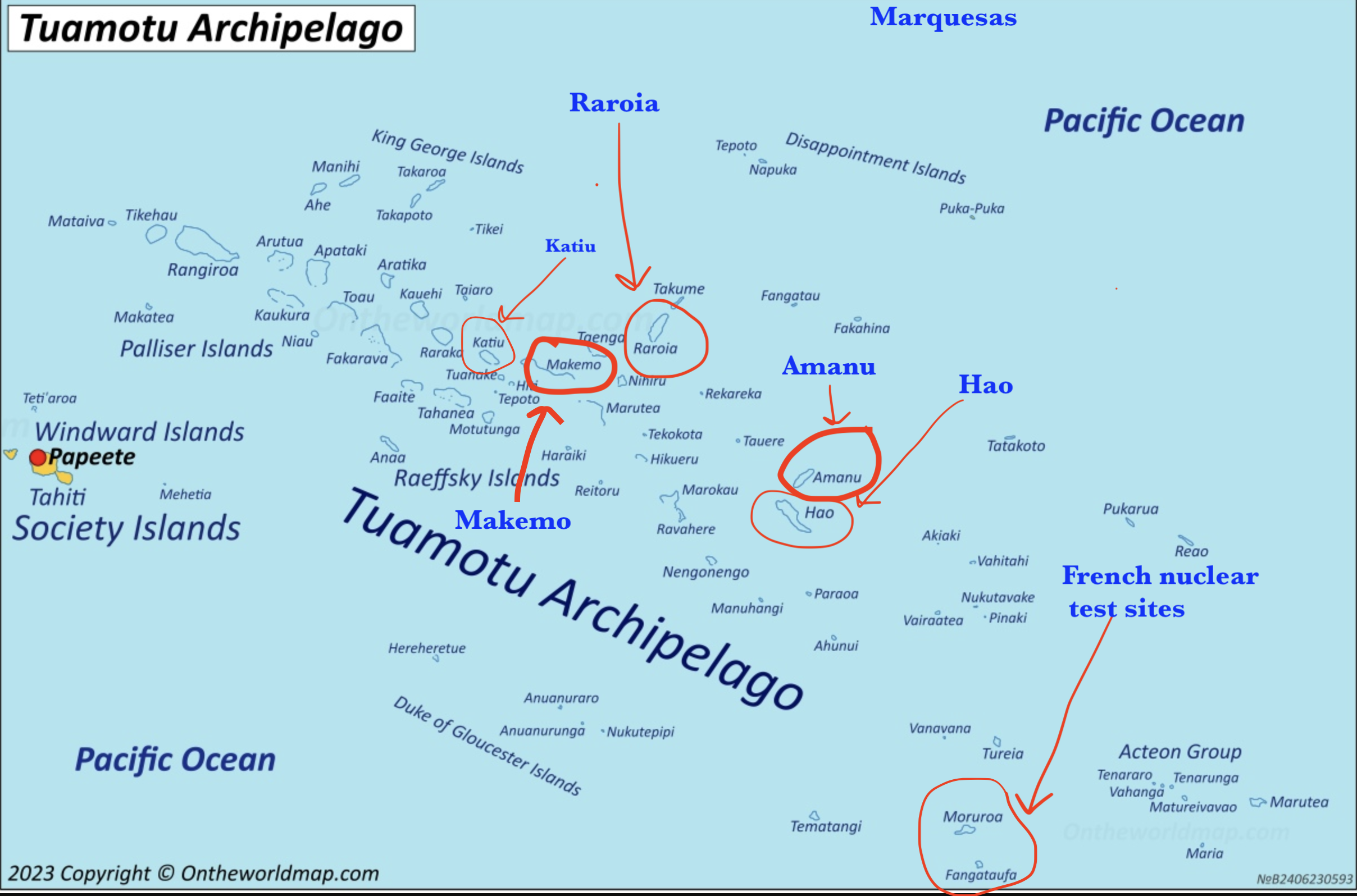
Map from Ontheworldmap.com
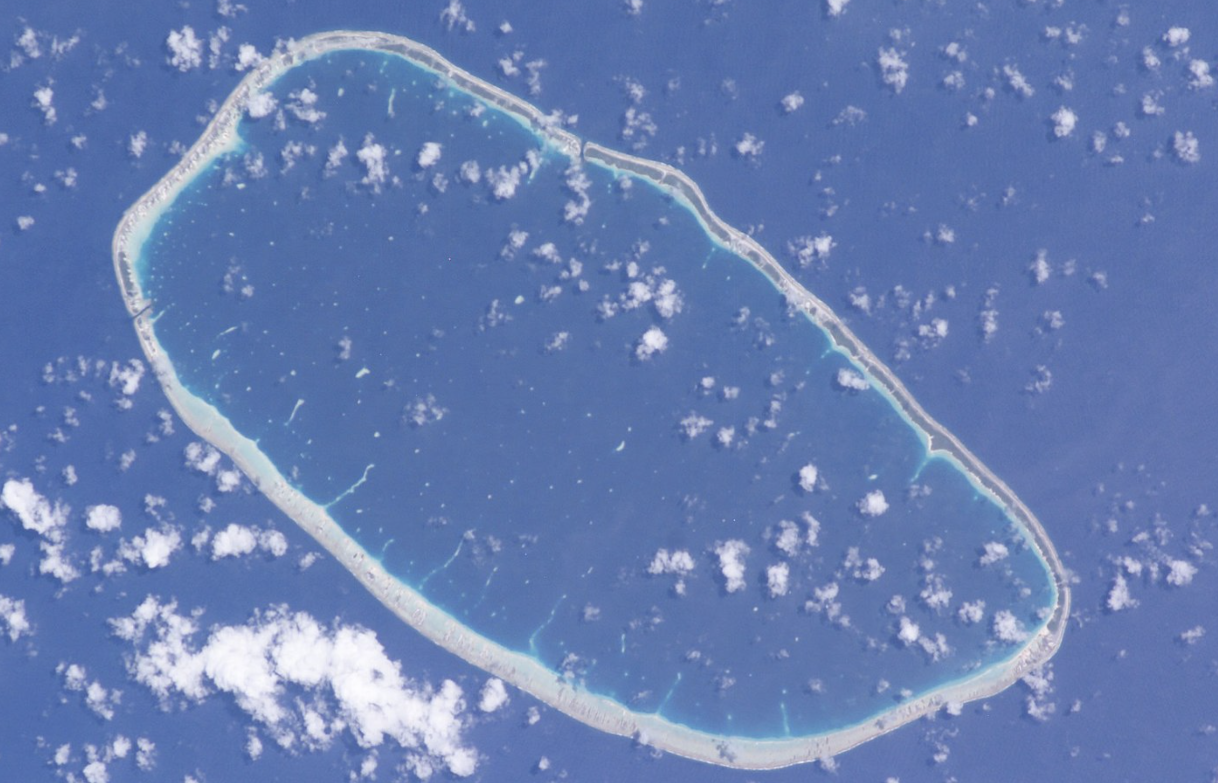
NASA image of Katiu
There are 2 main sources of written information about these atolls, one a cruiser-sourced site called NoForeignLand and the other a cruiser-sourced site called the Soggy Paws Compendium. There are cruising guides for French Polynesia; the most recent of these was last updated before 2020. Lots has stayed the same, of course (we love reading old cruising guides especially for the history), but a lot more has changed, including the accuracy of charts and GPS, and the use of satellite imagery.
The Compendium and NFL both offer some insight into whether people have actually been to atolls like Katiu, where the pass can be challenging. It was information in the Compendium, notably that from Bruce and Alene on Migration, that had us intrigued. They rave about the atoll and rank it as one of their favorites in all the Tuamotus.
The chart information, and even the satellite imagery, gave us pause. There was not a truly obvious way into the lagoon from the photos; charts suggested the depth was as low 3 feet in spots in the main channel. Migration is a trimaran with an unknown (presumed very shallow) draft. We debated getting in contact with them to see if they had more detailed intel to share, but in the end decided to do what we’ve done for decades of on and off cruising: be prudent and check out the channel with the dinghy before bringing the big boat in. There’s a dock in the pass where we could tie up if needed.
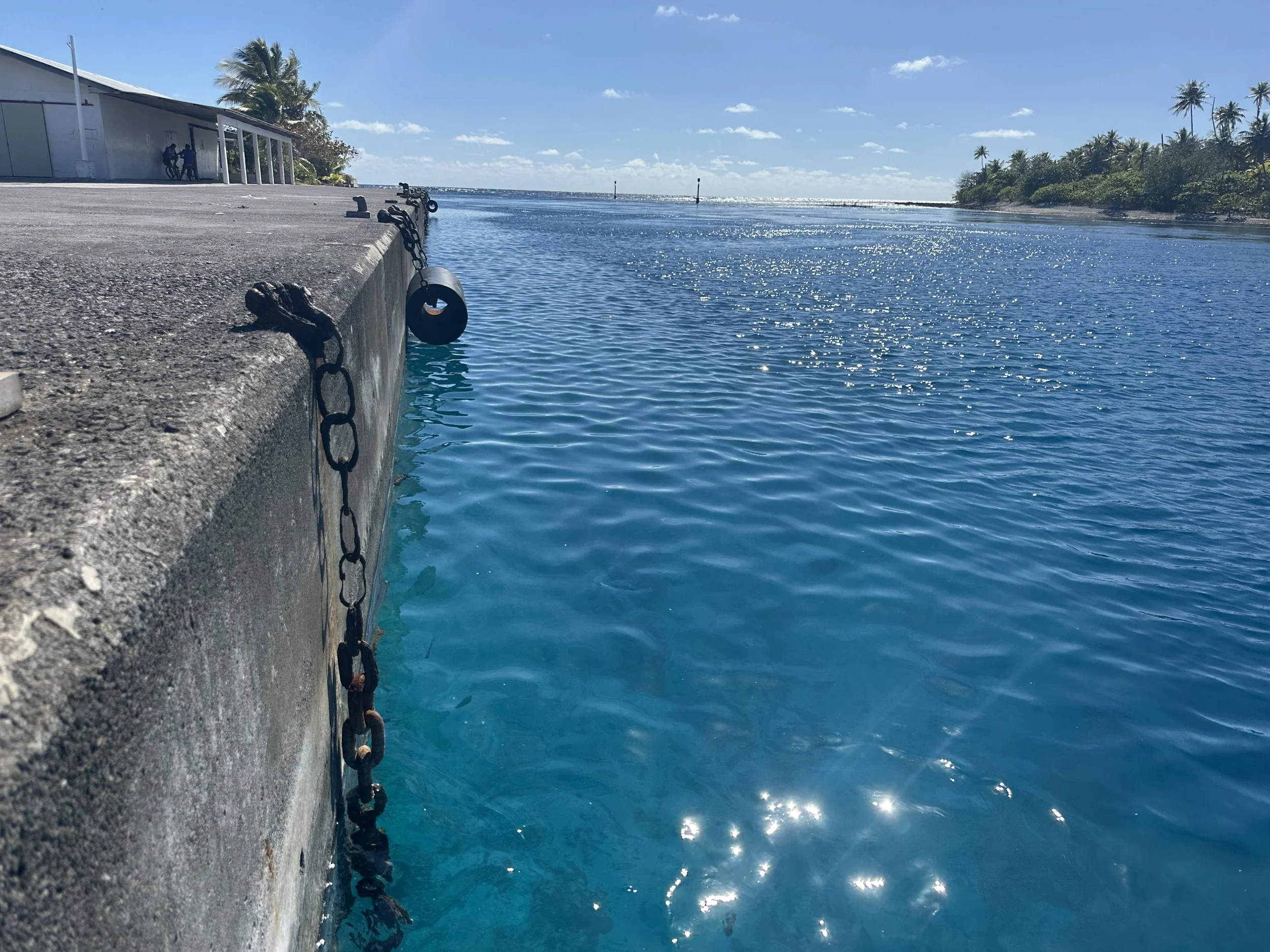
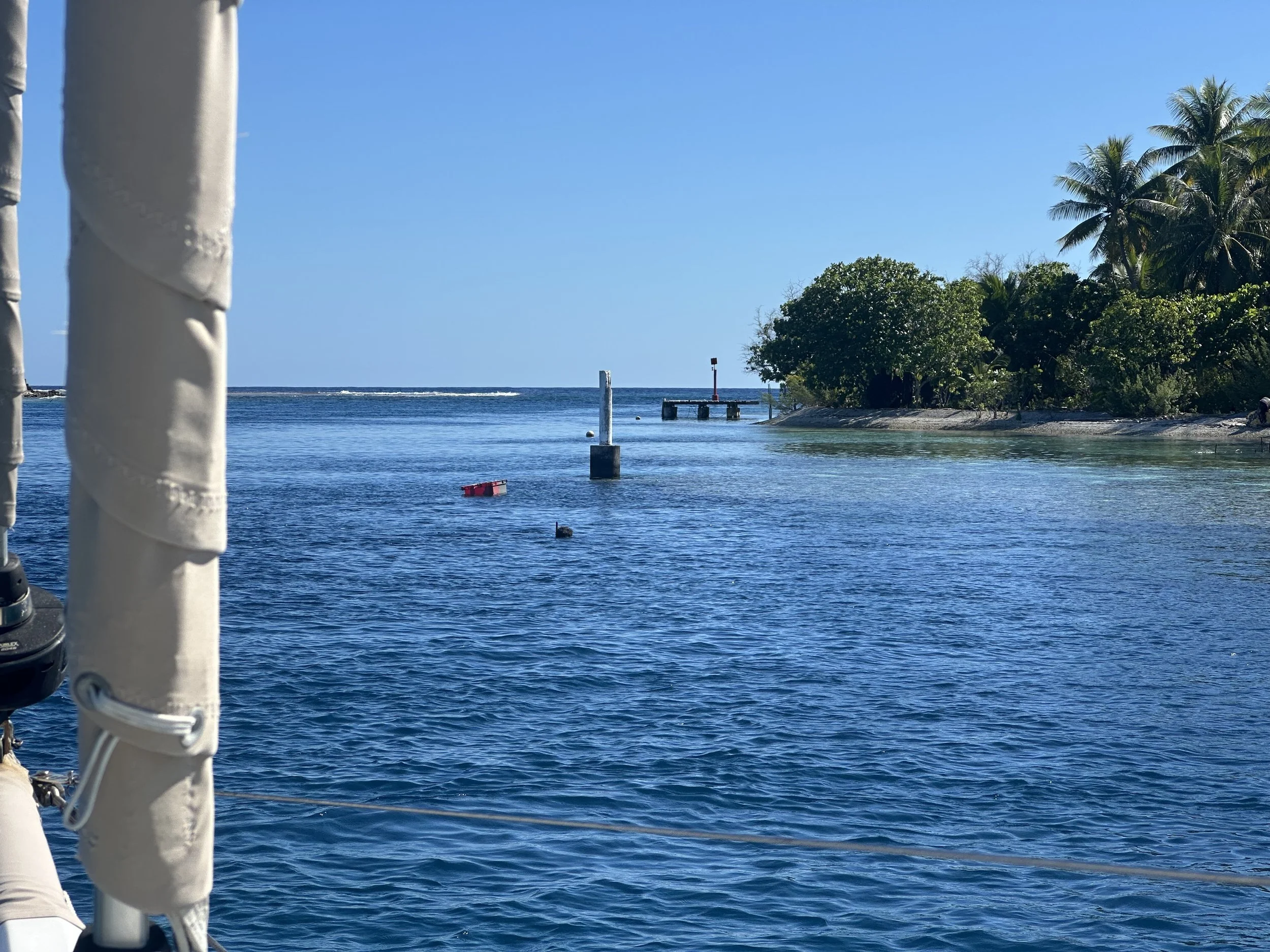
Katiu dock, looking out toward the Pacific
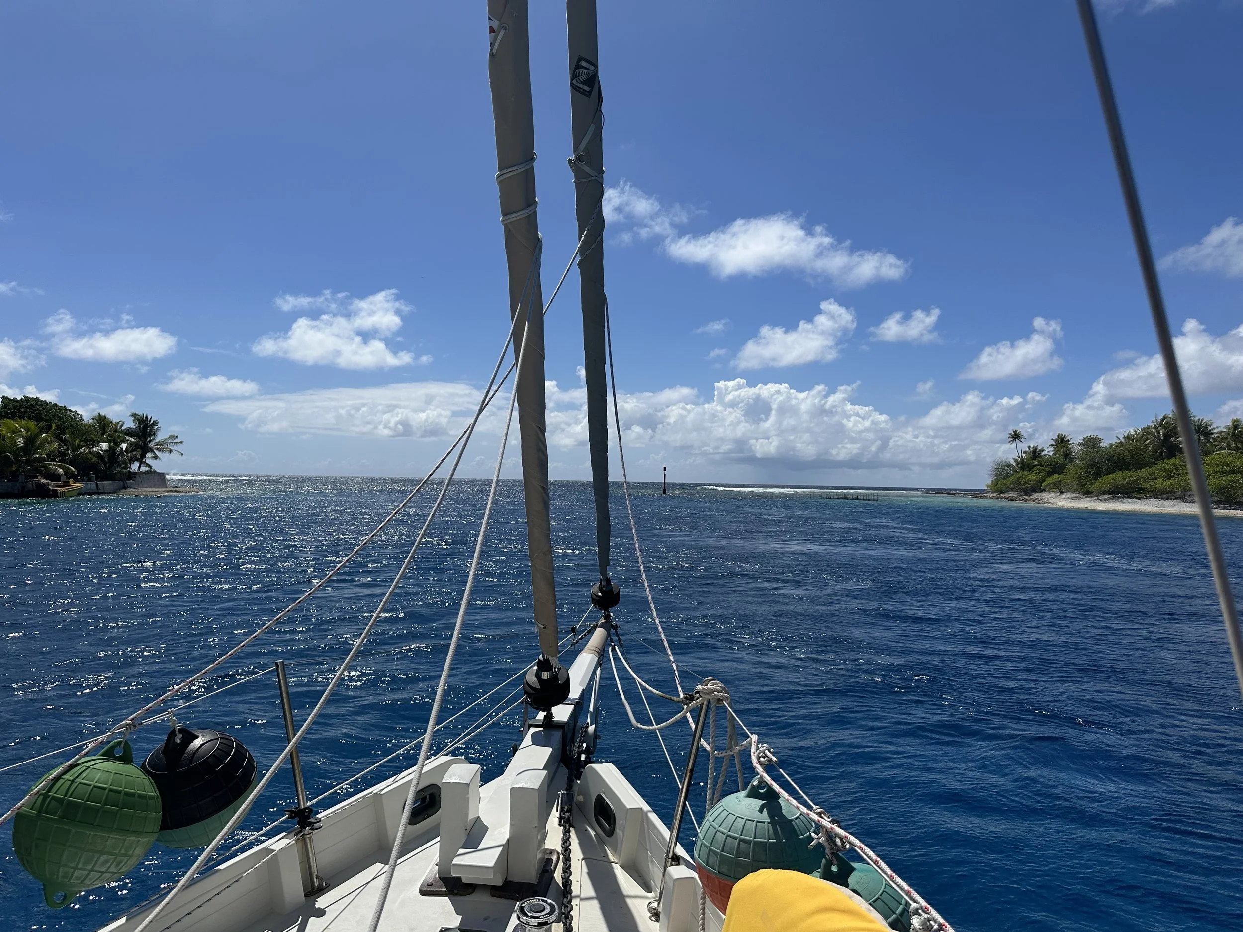
The pass into Katiu, Pass Pataka, consists of 2 parts. The first part is quite narrow but relatively straightforward. The narrowness of this part means that the current can really race, and there’s no way to angle in to stay out of a standing wave if you’re trying it in the wrong conditions. Boats that do visit Katiu often opt to end their entrance with this pass, since they can tie up to the supply ship dock that is right in the pass. It’s the second part that’s more challenging. Satellite imagery indicates 3 separate channels; the farthest east one is the one that’s deep enough for a sailboat. It’s maybe 50 feet wide at its widest, with a rocky outcrop on one side and a shallow coral reef on the other; it is this detail, and the equally critical depth, that was missing in our research.
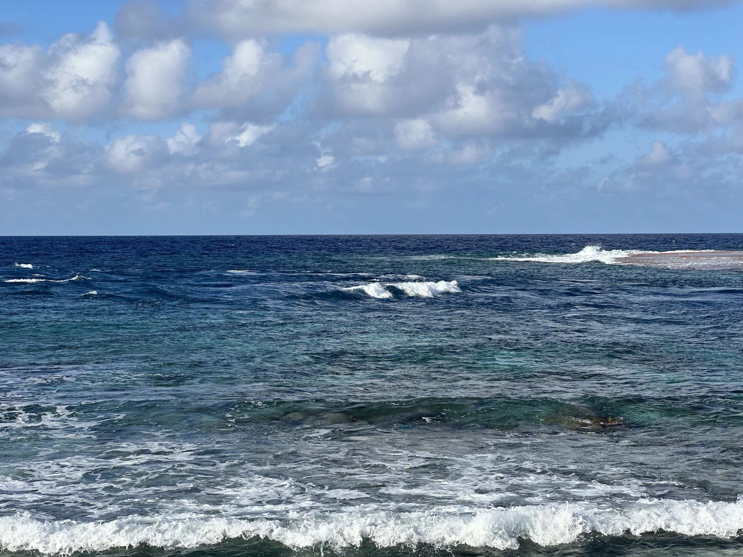
Looking out through the pass in not-great conditions. We’d not have attempted entry if it had looked like this!
We left Makemo with the dinghy still inflated but secured sideways over the cabin top. Less than ideal for visibility but this was a short passage - just 25 miles in mild conditions - and we knew we’d need the dink for reconnaissance on a tight timeline. We don’t tow the dinghy in open water; normally we’d deflate Roti and stow her in a tidy package on the turtle hatch but it takes a little bit of time to set her back up, time we weren’t sure we’d have to spare. So the strange arrangement. Which I forgot to take a photo of. Sigh.
Leaving Makemo out the western pass.,
To make a long story short, it all worked beautifully. We arrived with a little bit of flood current, anchored in crystal clear water in 50 feet in the pass, launched the dinghy, put the outboard on, and off went Jeremy with his trusty sounding pole - the SUP paddle marked with our draft. I stayed on the boat in case we dragged anchor. By the time Jeremy returned with the news that the channel was plenty deep enough, the current had slowed even further. Up went the anchor and into the lagoon we went.
Anchored in the pass, sitting to the incoming current and wind
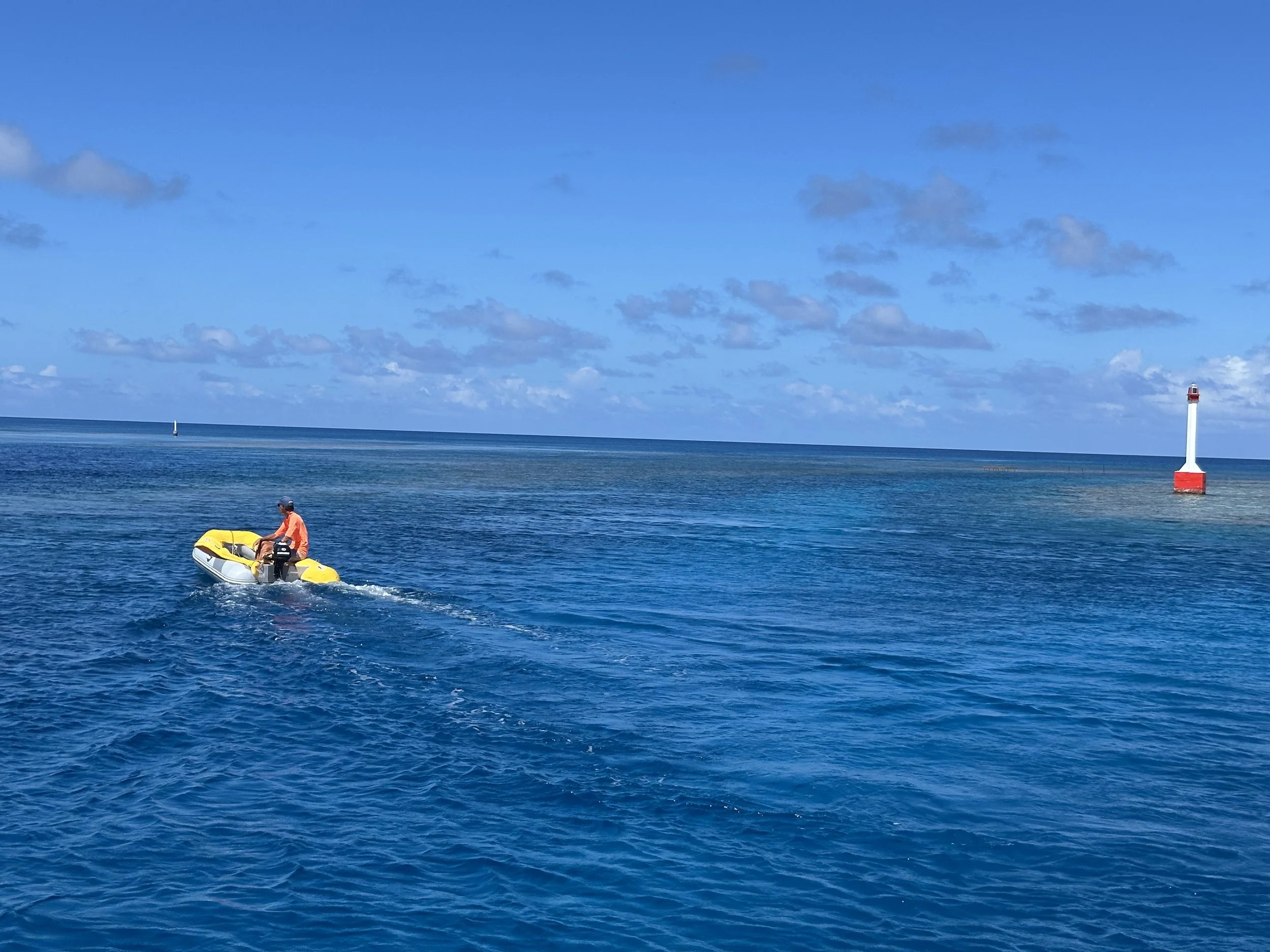
Jeremy heading out to scout the pass. No, the closer channel is NOT where you go!
We spent just shy of 2 weeks in Katiu, on the eastern half, and found a lot to enjoy. We were the only cruising boat in the lagoon.

NASA image
Anchorage #1: off of the town. Katiu’s village is called Toini, and it’s peaceful and sleepy. The dominant feature is a massive Catholic church that is visible from a distance. Its rainbow painted louvers on the steeple were a colorful touch. There’s one small magasin that carries the usual basics, including the weirdly omnipresent Skippy peanut butter (there were also plenty of onions, garlic, and potatoes) and seemed to be the hotbed of social activity the morning we were there. It’s small enough that if there are too many people inside you’ll need to wait outside before going in. There’s a mairie (the government building), a Poste, a couple of open-only-on-the-weekend snacks, and 2 paved roads. There is an RO plant for water, though it’s really as back up for the water catchment and cisterns that are the mainstay of potable water. The anchorage is more coral-heavy than we prefer, and less protected from easterly sector winds., so after 2 nights we moved south.
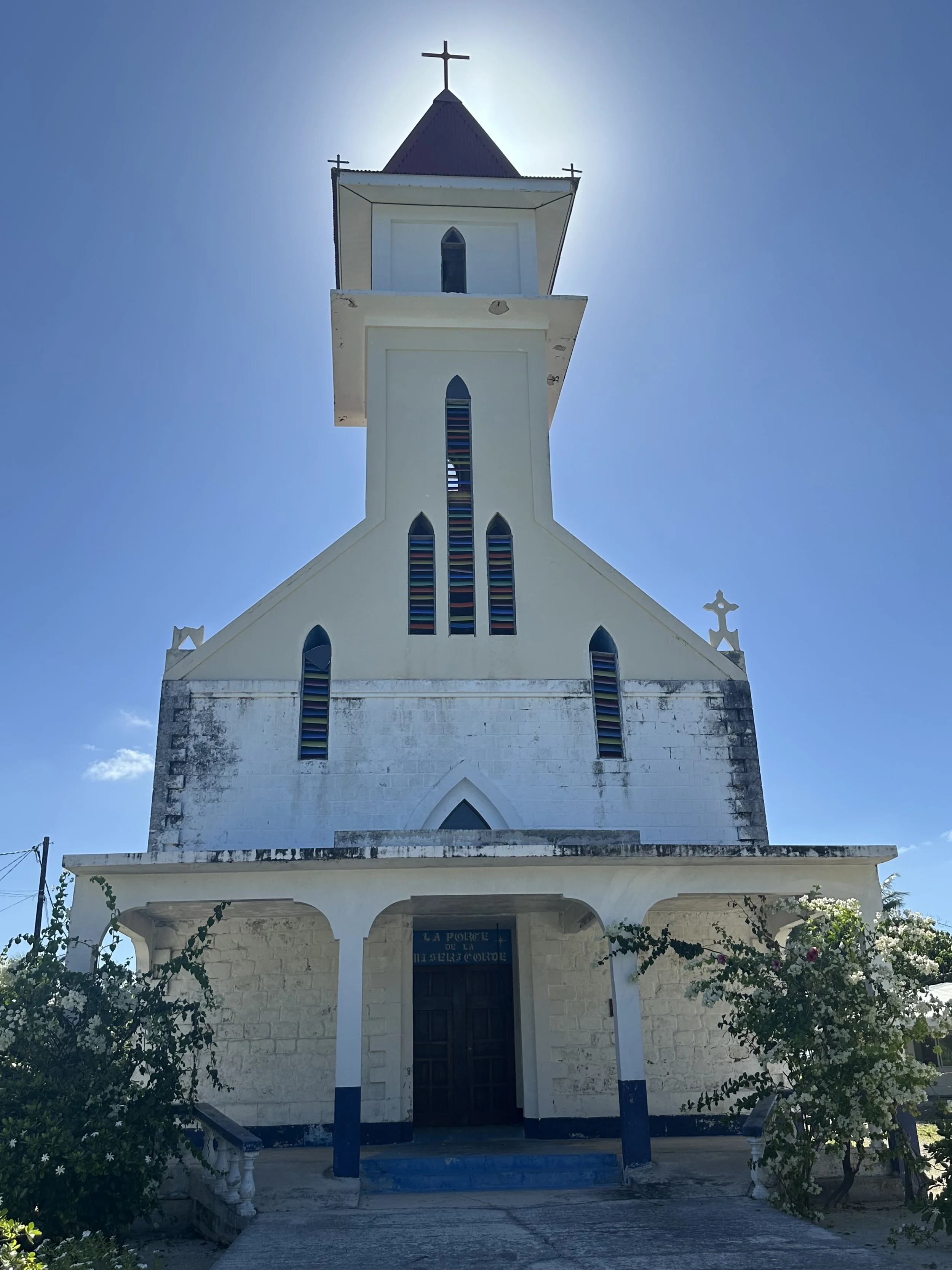
Catholic church in Katiu. I’d have to imagine the whole population could fit inside!
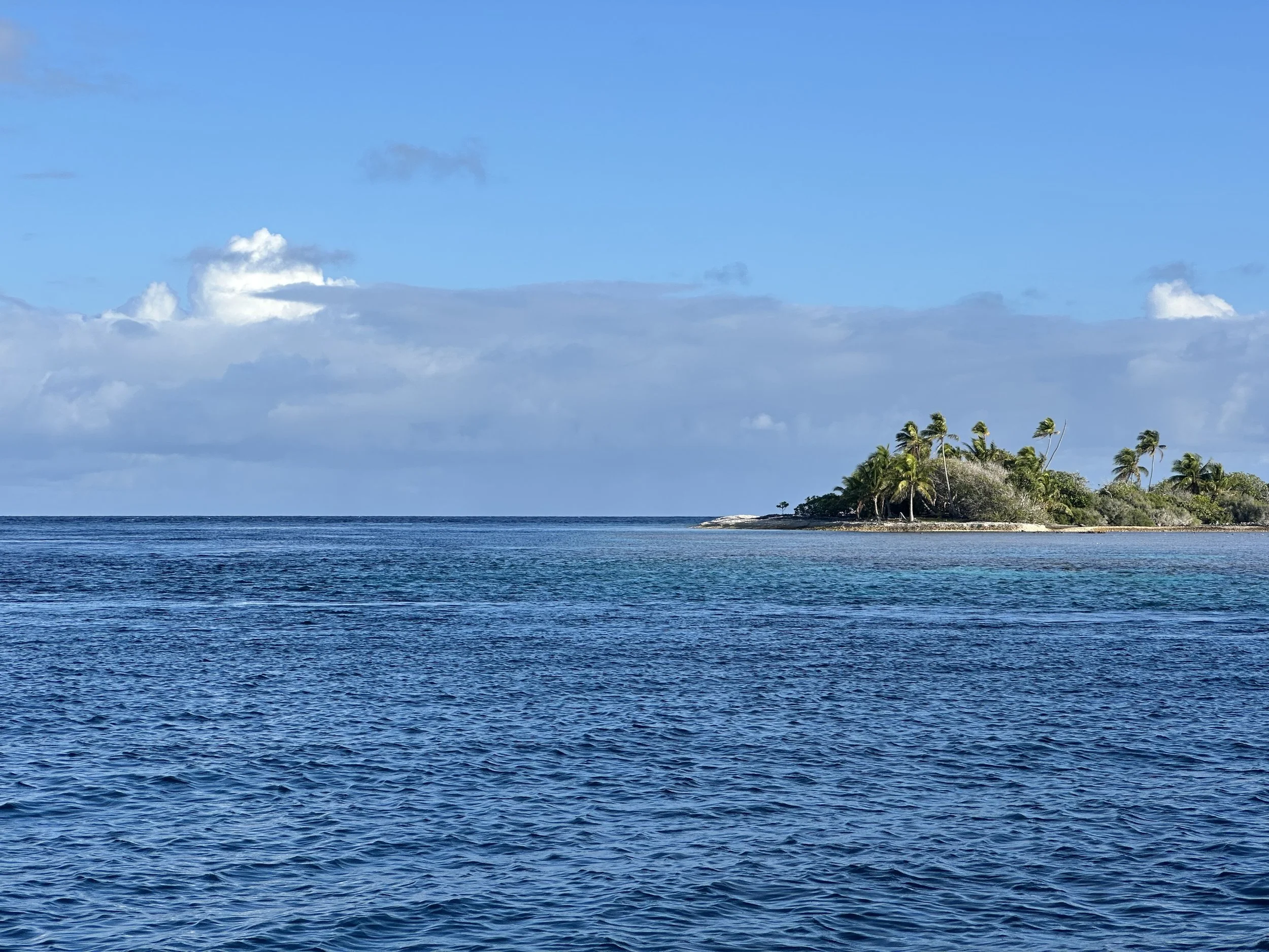
Anchorage #2, which Jeremy named Katiu East, was at the southeastern “corner”. The beach is the standard coral rubble, shoes-required, kind of beach, and Jeremy’s love of bushwhacking came in handy as he struggled to find a clear path to the ocean side. We did some dinghy exploring to a nearby motu with palm trees on it and found an almost perfect triton shell just perched on the coral berms. Nobody was home, so it’s on board Calypso now, waiting to be mounted as art.
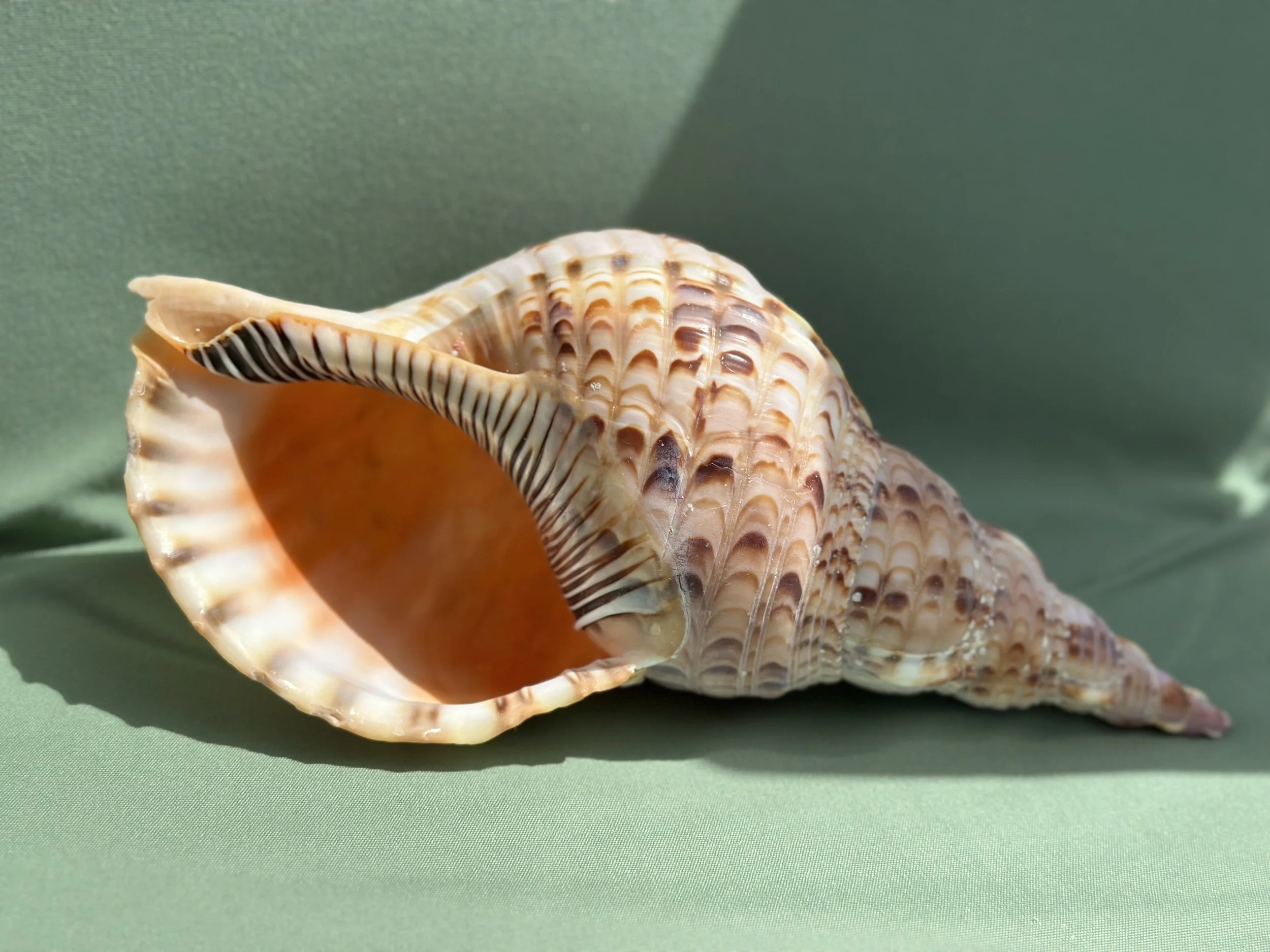
An almost perfect triton! What a find!
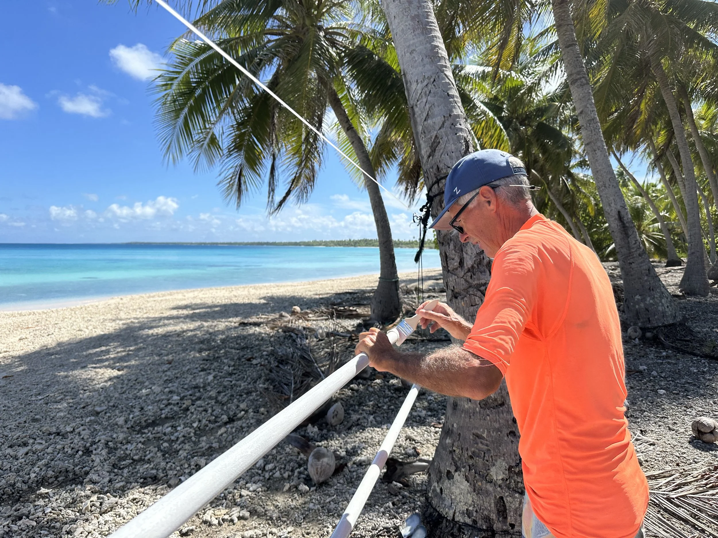
Final coat of paint on our awning poles. Nice workshop view!
Art was the name of the game at this anchorage for me too. I recently completed Julia Cameron’s The Artist’s Way, and one of her tasks in later weeks is to build an artist’s altar. This is a tough proposition on the boat, space-wise, and the idea of a digital one didn’t sit right with me. Clare Egan, a writer I follow on Substack and who led a community through TAW, suggested a temporary one, an idea I found incredibly appealing. It also gave me a focus for beach walks while Jeremy was putting a final coat of paint on awning poles.
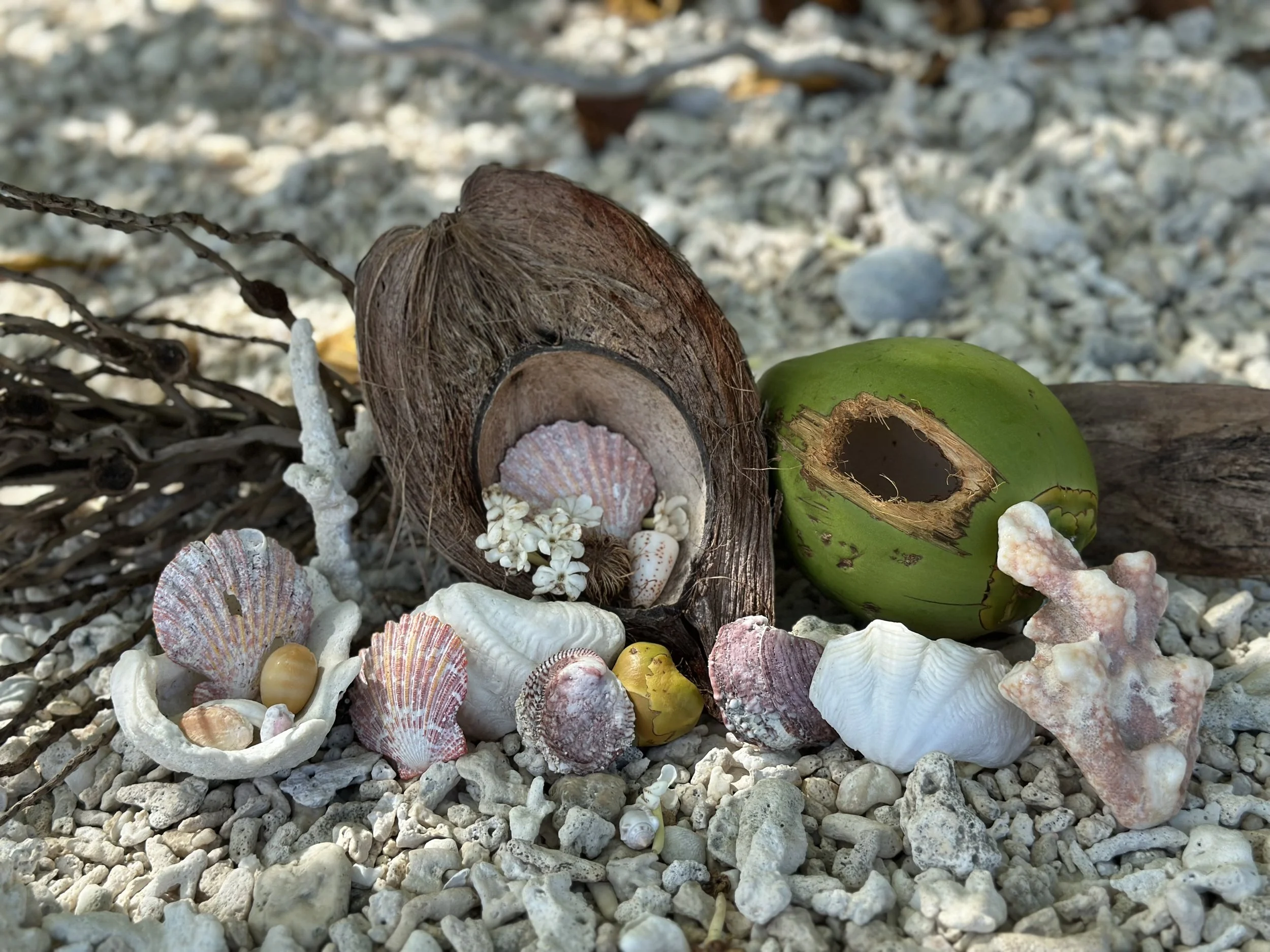
Artists altar left at Katiu East.
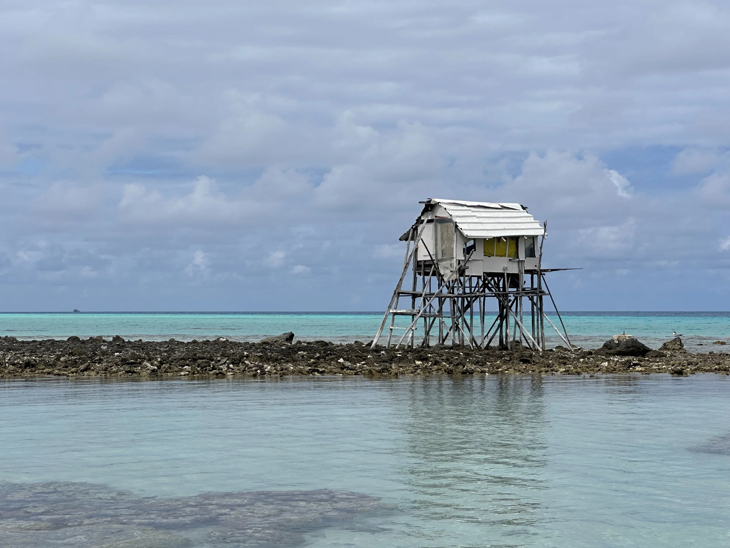
Anchorage #3 was at La Grande Plage. (Jeremy has the best time naming new spots on NoForeignLand!) Wide swath of tidal flat beach. An actual beach, like the kind you can go barefoot on! There’s a copra shack at the end of the beach that seems to have been taken over as a party destination; Jeremy spent a lot of time tidying the space, hanging up pearl floats and hardhats he found on his walks, organizing the trash into barrels, and even repurposing a FAD as a solar light that he left there.
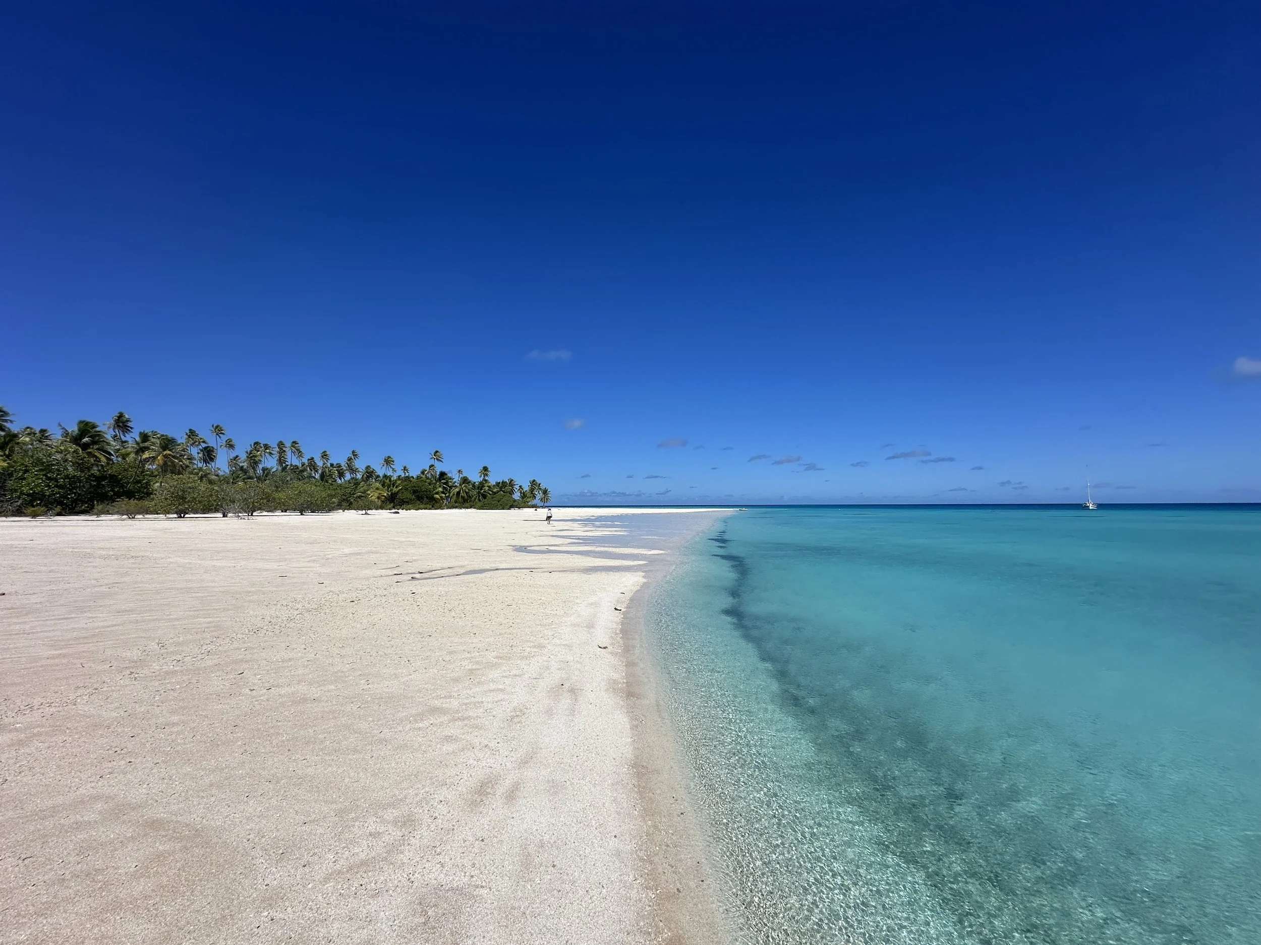
La Grande Plage is grande indeed!
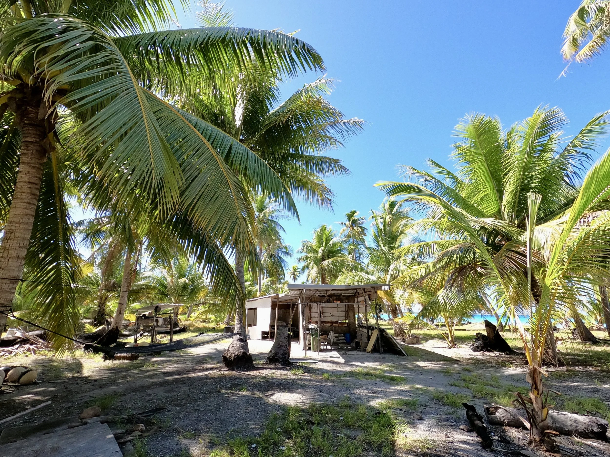
Copra shack, all tidied up
We moved up the coast a little to anchorage #4, a spot we dubbed La Petite Plage. We wanted to get closer to the working pearl farm, to see if we could learn about this industry from something other than the internet.
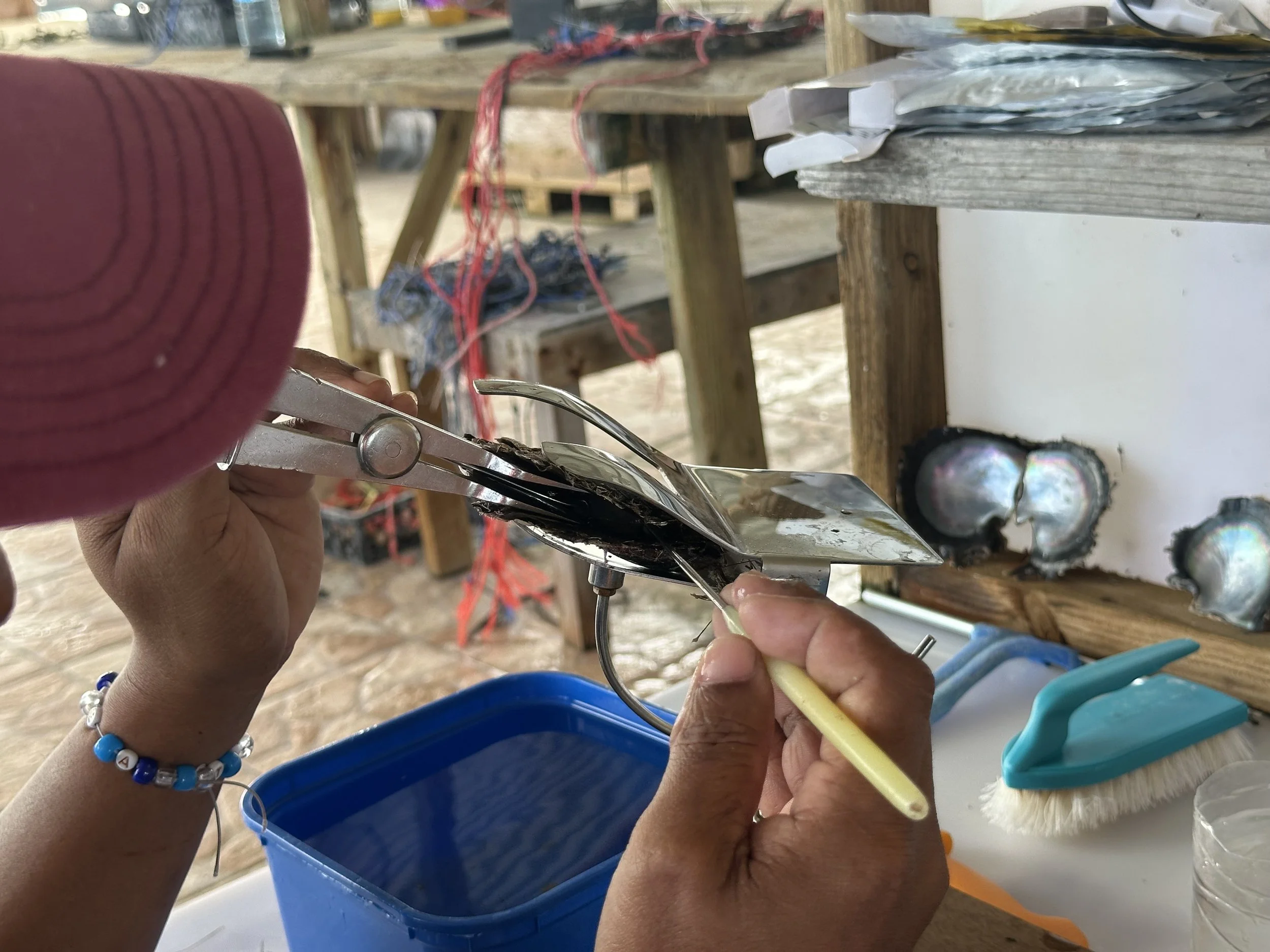
Dental tools are involved . . .
“Tour” might be a stretch, but we encountered friendly people who, after a call to “the big boss” in France, were happy to talk to us about their work. It’s labor intensive and fairly involved, relying on some natural occurrences (growing the baby oysters starts with a line in the water that catches wild larvae, along with a lot of other stuff, and then is manually culled) and some more scientific culturing (grafters carefully insert a bio-nucleated bead that comes from Mississippi (!!!!) along with a bit of color-providing nacre and a bit of shell). I’ll do a more in-depth blog post once we’ve done a couple more tours. Suffice it to say, it’s a team effort and an impressive operation.
Manually pulling baby oysters from these lines . . .
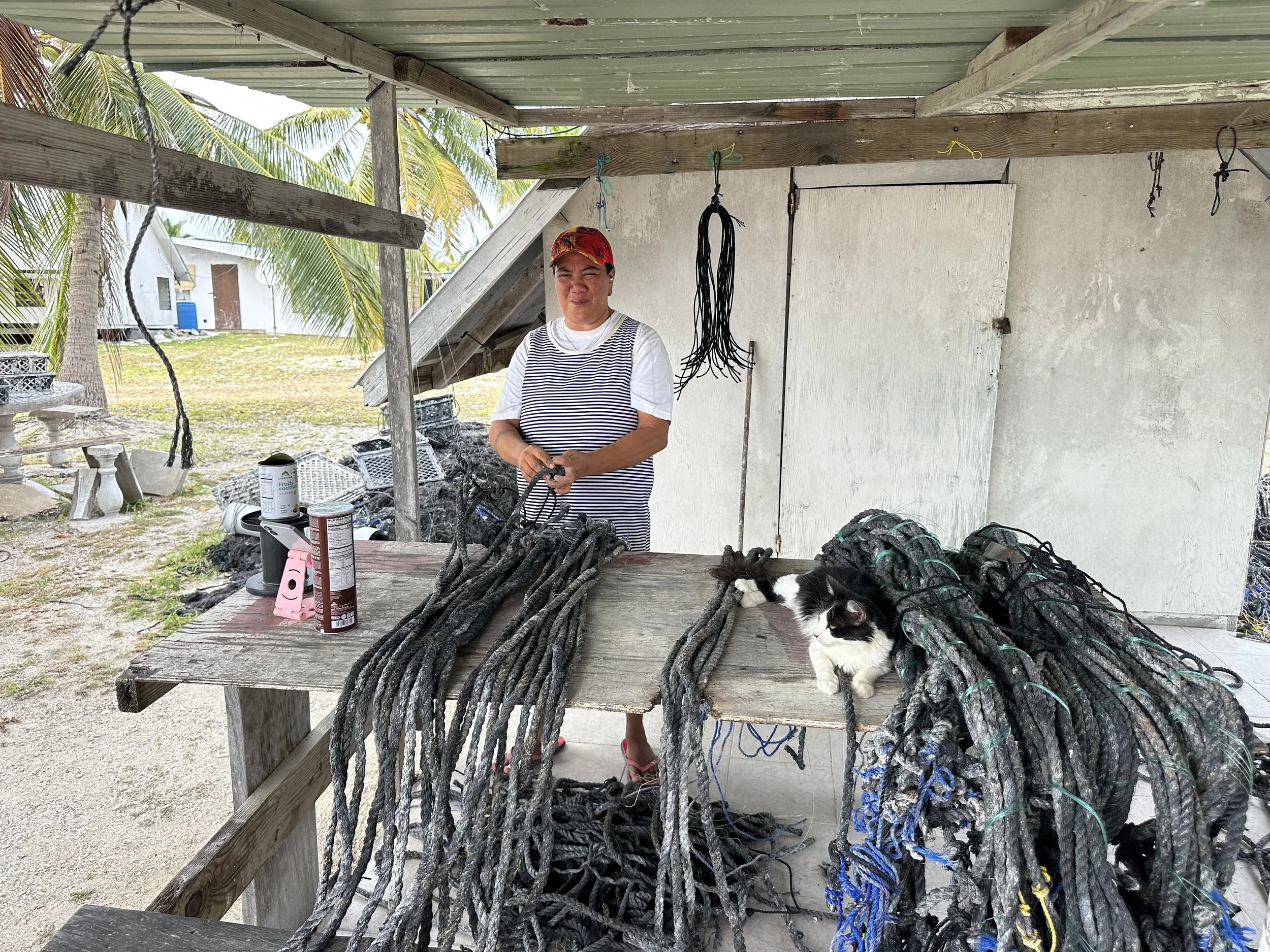
Prepping lines to attach grafted oysters. The supervisor has a critical job.
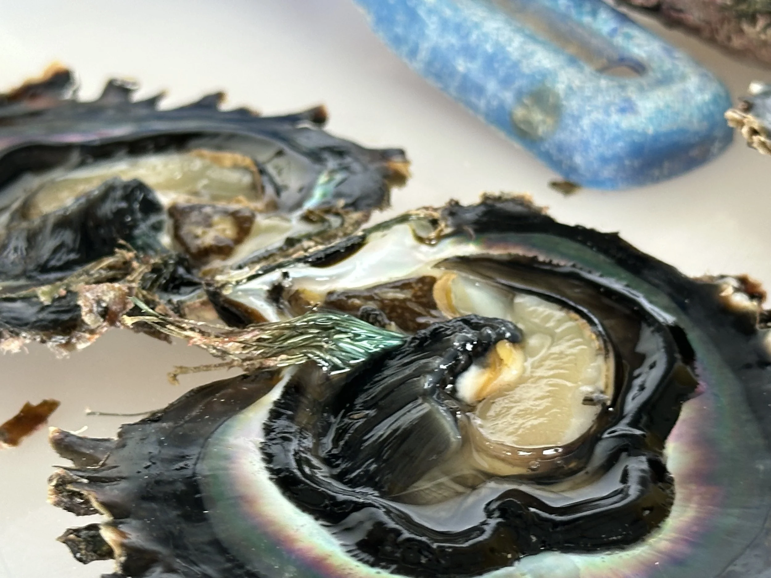
I honestly don’t know what stage this is. It’s pretty, though!
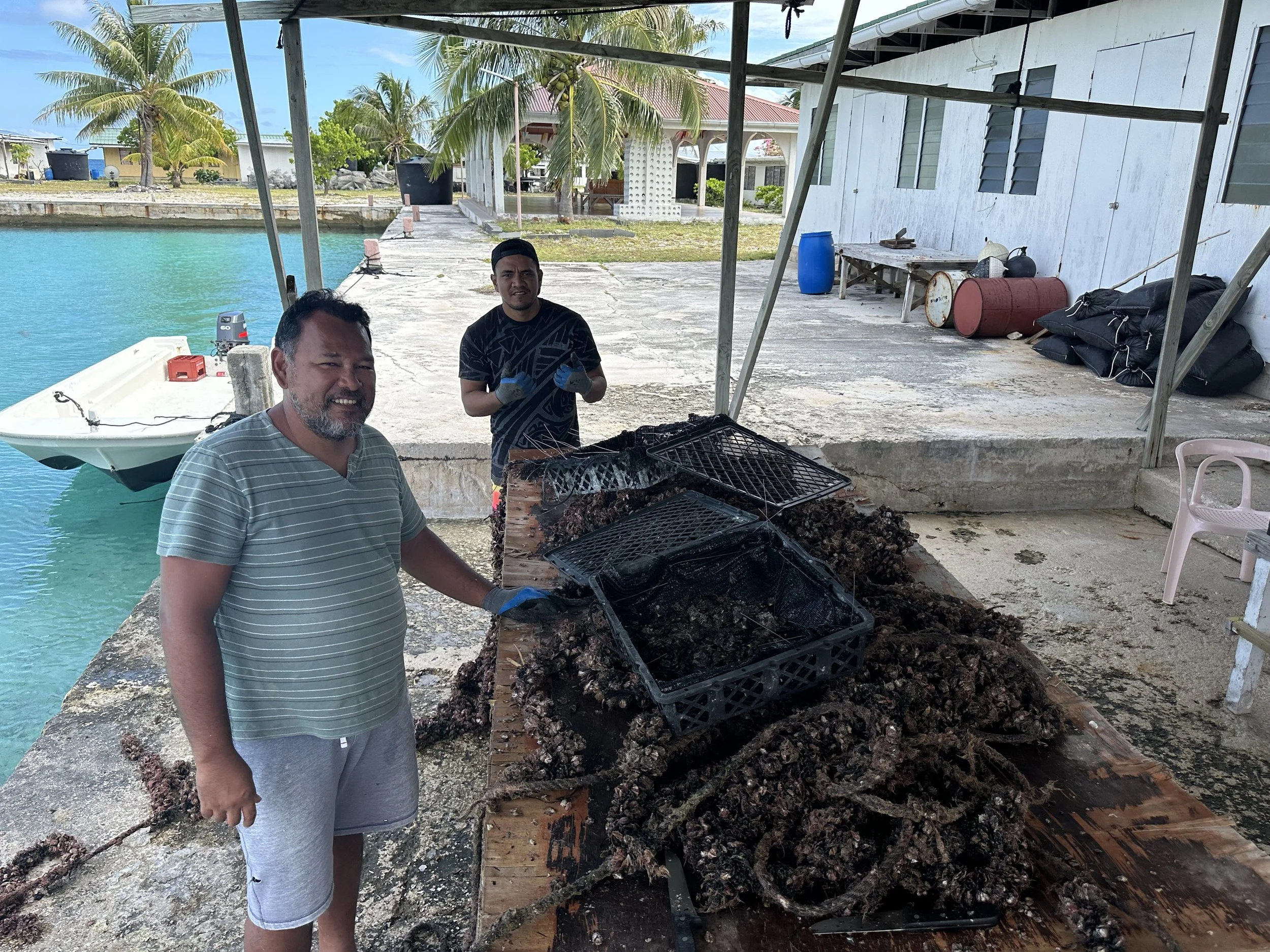
At Petite Plage we also met a trio of copra workers who were collecting their coconut harvest to take to town where they had a drying set up. They stopped by the boat on their way home just to chat, offering up some of the fish they’d caught earlier and asking us where we’d come from.
Private villa with endless lagoon views
Back to La Grande Plage for more work at the shack and to enjoy the scenery for a few days, and then it looked like we had weather coming in and a decision to make. Do we stay in Katiu, likely back at the Katiu East anchorage, or move on? The tide and light combination was favorable for exiting the pass, and we could get better protection at the next atoll over. Or do we go all the way to Takaroa, a 120 mile passage?
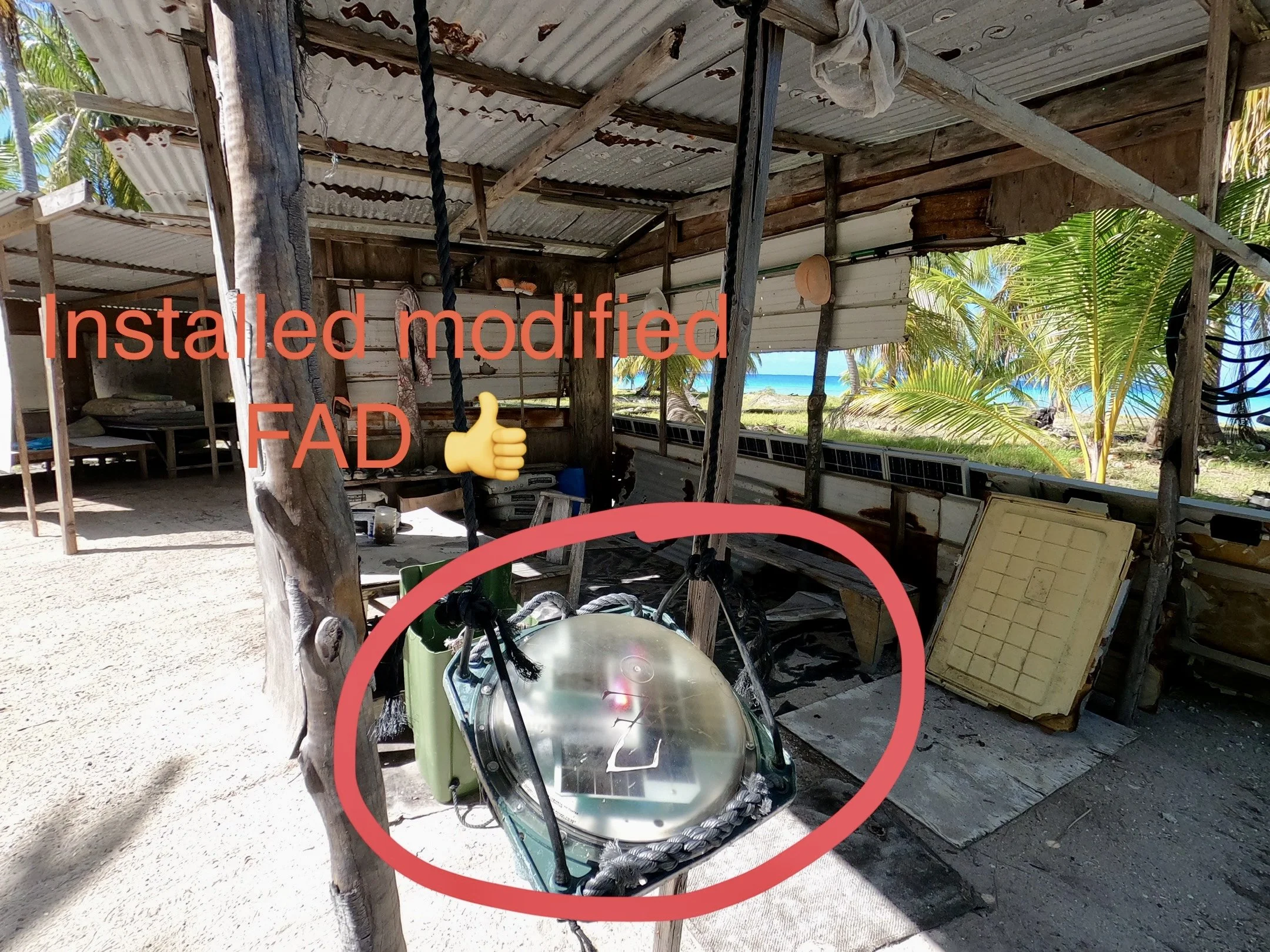
Waterproof solar light from materials found on the reef
Artist’s altar, Grande Plage. Not much color available on this beach!
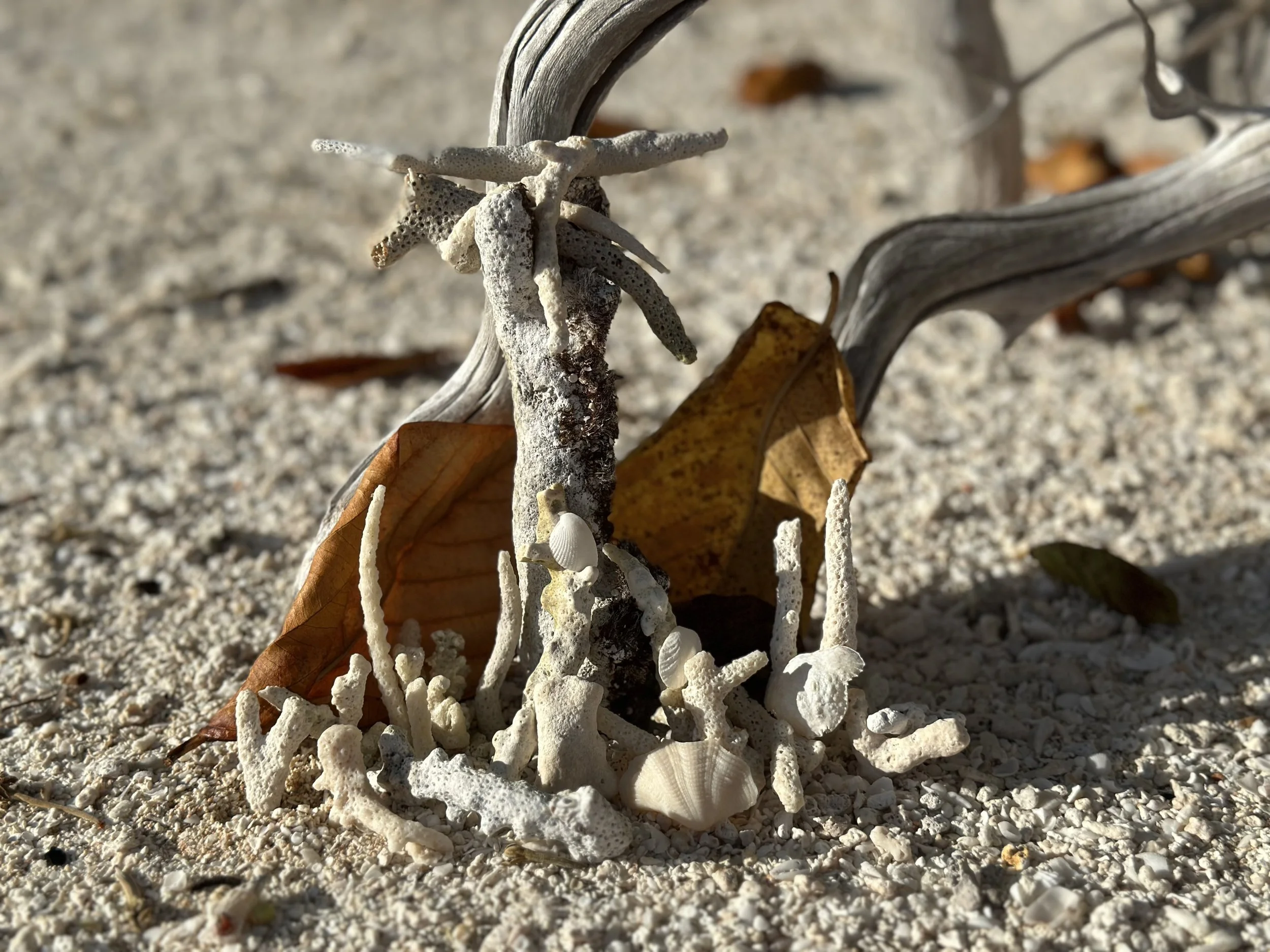
Patterns fascinate me!
First steps first. Get closer to the pass for a morning departure. Off to anchorage #5, really only suitable in north (or very light) winds. This anchorage almost wound up being named “Barky Dog Kao” (a “kao” is the name for a reef that extends out from land, like a sand spit only made of coral) due to the endlessly barking dog ashore but received the more-helpful moniker of “Katiu Pass East Anchorage”. Right off of what we guess is an old pearl farm repurposed as a copra grove work place, it’s a pretty spot with a glorious view of the sunset over the town.
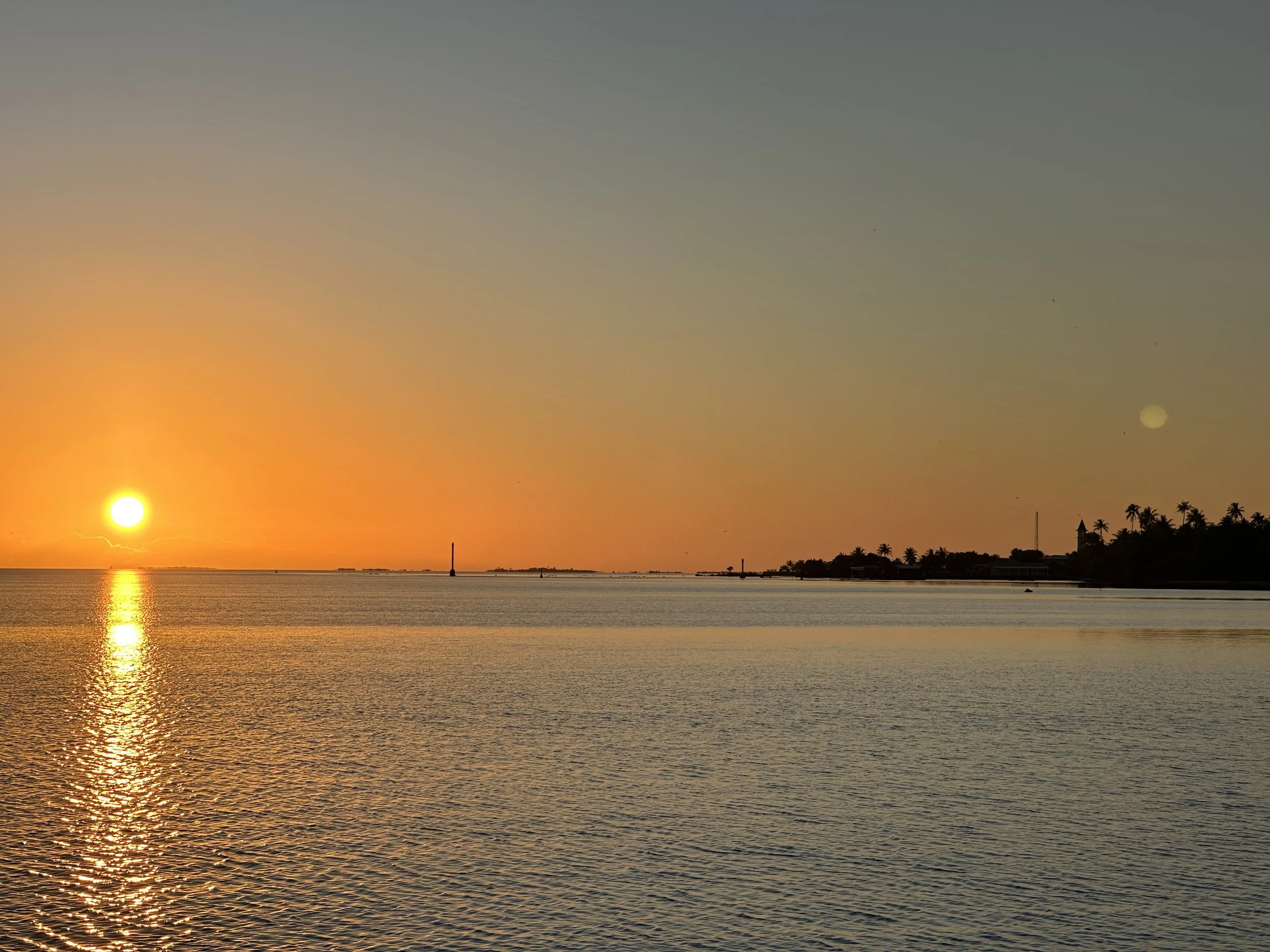
Sunset over Toini from Katiu Pass East
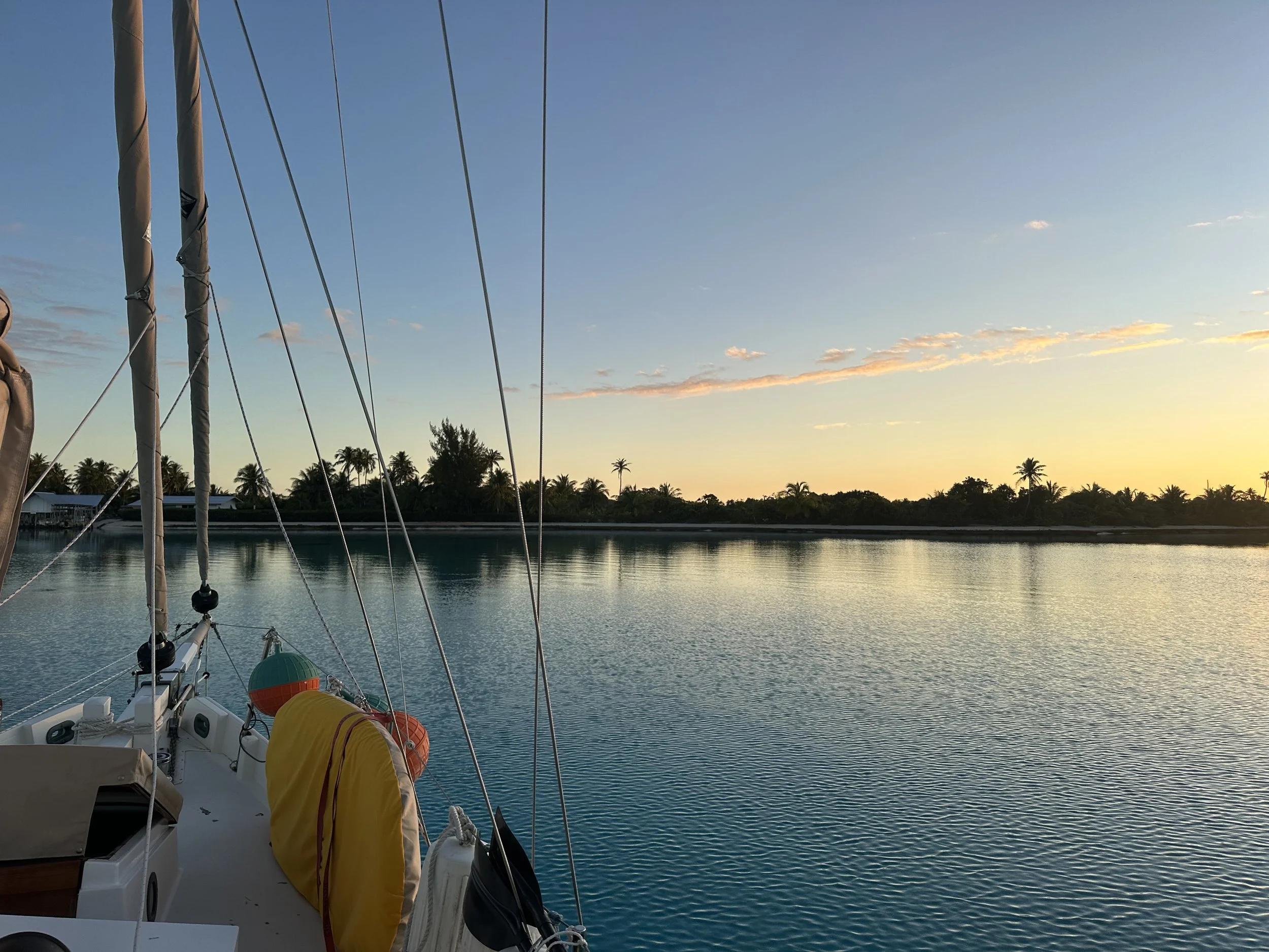
And in the morning, after a glorious sunrise, we picked our way back through the pass and headed northwest. Would it be Raraka? Or would it be Takaroa? Time will tell!
Sunrise over Katiu
Dodging spearfishermen in the pass on our exit